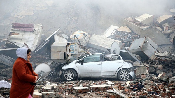
More than 2,000 people have been killed and thousands injured by a huge earthquake which struck south-eastern Turkey, near the Syrian border, in the early hours of Monday morning.
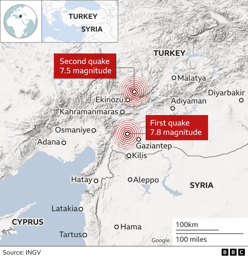
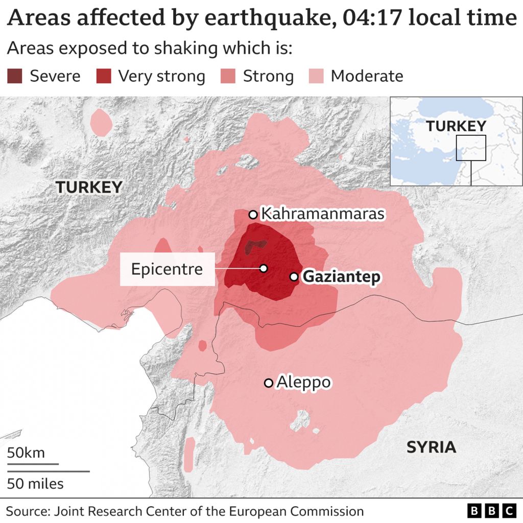
The earthquake, which hit near the town of Gaziantep, was closely followed by numerous aftershocks - including one which was almost as large as the earthquake itself.
Why was it so deadly?
It was a big earthquake - registered as 7.8, classified as "major" on the official magnitude scale. It broke along about 100km (62 miles) of fault line, causing serious damage to buildings near the fault.
READ ALSO: Christian Atsu 'trapped in rubble' after earthquake in Turkey
Prof Joanna Faure Walker, head of the Institute for Risk and Disaster Reduction at University College London, said: "Of the deadliest earthquakes in any given year, only two in the last 10 years have been of equivalent magnitude, and four in the previous 10 years."
But it is not only the power of the tremor that causes devastation.
This incident occurred in the early hours of the morning, when people were inside and sleeping.
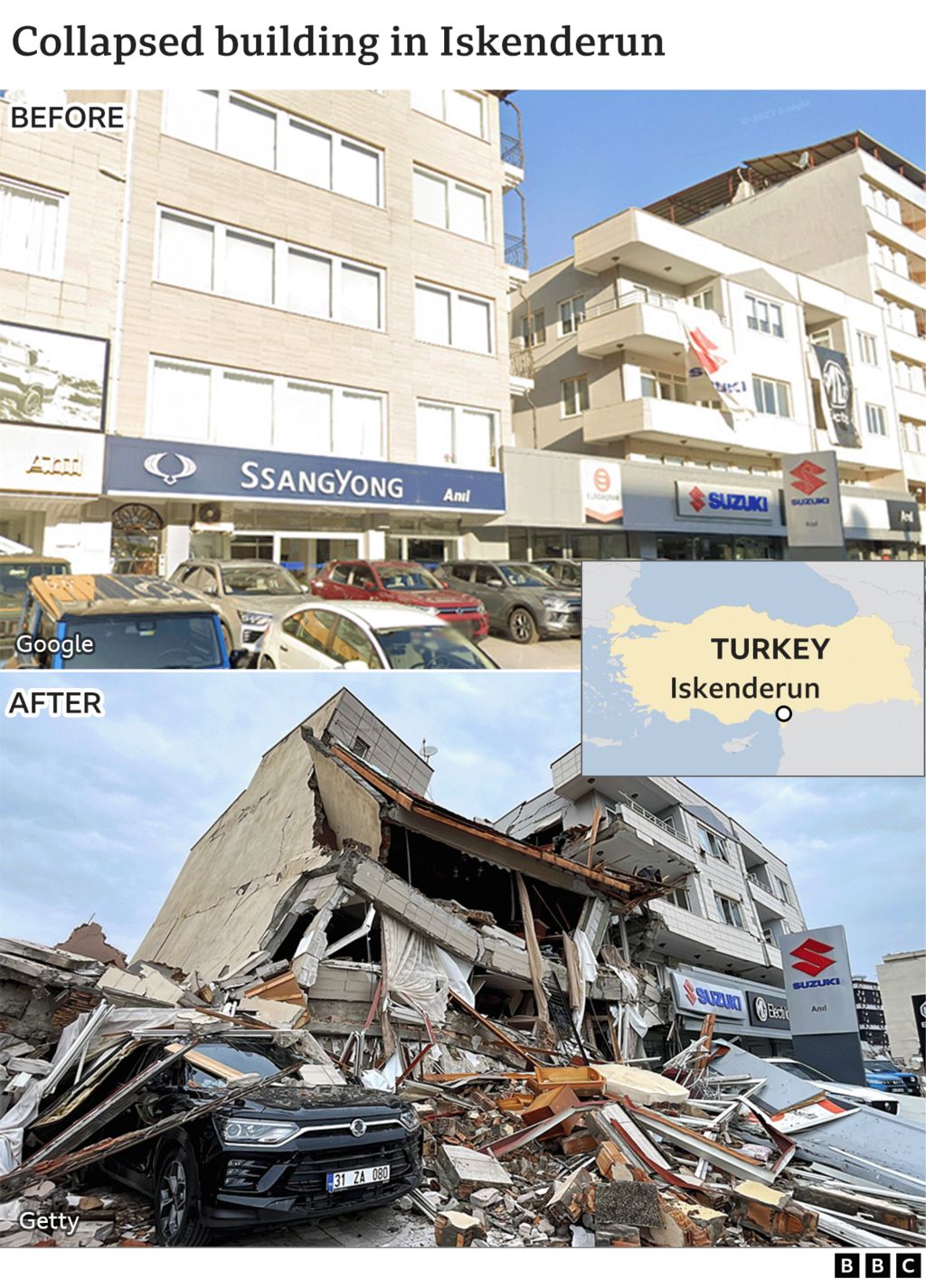
The sturdiness of the buildings is also a factor.
Dr Carmen Solana, reader in volcanology and risk communication at the University of Portsmouth, says: "The resistant infrastructure is unfortunately patchy in South Turkey and especially Syria, so saving lives now mostly relies on response. The next 24 hours are crucial to find survivors. After 48 hours the number of survivors decreases enormously."
This was a region where there had not been a major earthquake for more than 200 years or any warning signs, so the level of preparedness would be less than for a region which was more used to dealing with tremors.
What caused the earthquake?
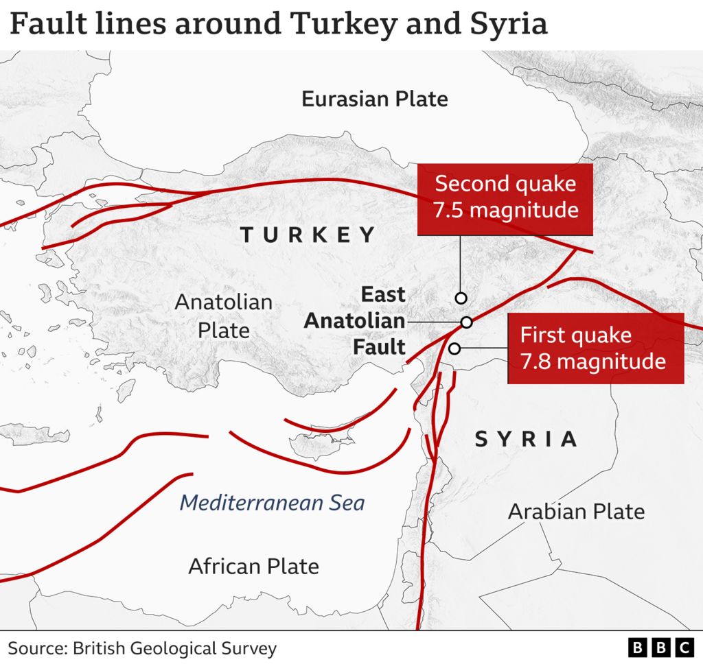
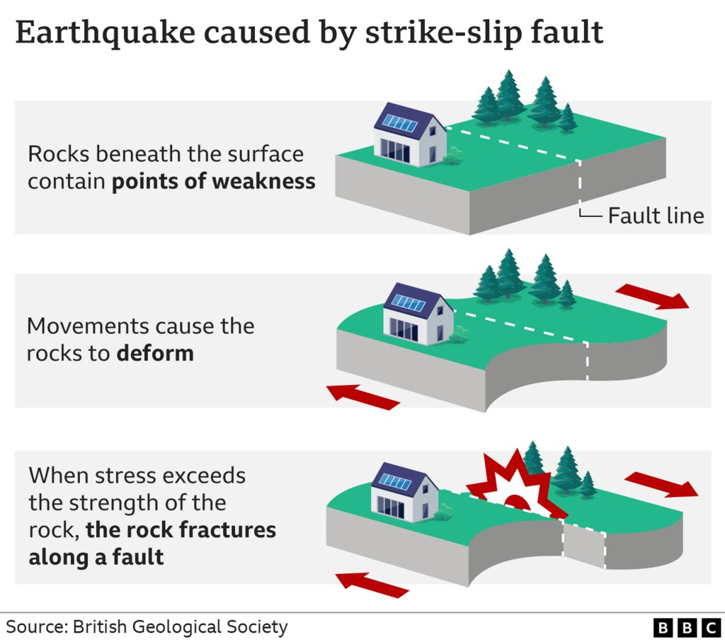
The Earth's crust is made up of separate bits, called plates, that nestle alongside each other.
These plates often try to move but are prevented by the friction of rubbing up against an adjoining one. But sometimes the pressure builds until one plate suddenly jerks across, causing the surface to move.
In this case it was the Arabian plate moving northwards and grinding against the Anatolian plate.
Friction from the plates has been responsible for very damaging earthquakes in the past.
On 13 August 1822 it caused an earthquake registering 7.4 in magnitude, significantly less than the 7.8 magnitude recorded on Monday.
Even so, the 19th Century earthquake resulted in immense damage to towns in the area, with 7,000 deaths recorded in the city of Aleppo alone. Damaging aftershocks continued for nearly a year.
There have already been several aftershocks following the current earthquake and scientists are expecting it to follow the same trend as the previous big one in the region.
How are earthquakes measured?
They are measured on a scale called the Moment Magnitude Scale (Mw). This has replaced the better known Richter scale, now considered outdated and less accurate.
The number attributed to an earthquake represents a combination of the distance the fault line has moved and the force that moved it .
A tremor of 2.5 or less usually cannot be felt, but can be detected by instruments. Quakes of up to five are felt and cause minor damage. The Turkish earthquake at 7.8 is classified as major and usually causes serious damage, as it has in this instance.
Anything above 8 causes catastrophic damage and can totally destroy communities at its centre.
How does this compare with other large earthquakes?
The earthquake off the coast of Japan in 2011 was registered as magnitude 9 and caused widespread damage on the land, and caused a series of giant tidal waves - one of which led to a major accident at nuclear plant along the coast.
The largest ever earthquake was 9.5 recorded in Chile in 1960.
BBC

